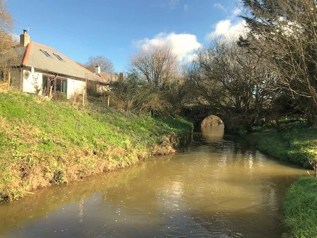
We start this final part of the canal walks at the Falcon Bridge and we have just seen something of its history in the Bude Harbour Walk. But just to briefly repeat the story here. The first bridge was built here was in 1820 at the time of the construction of the canal. It was a simple two-piece wooden structure that could swivel to accommodate the passage of the ships. Despite it being capable of accommodating large ships, when the Lifeboat House was built in 1863 (see next page) together with a new lifeboat that could be launched in the canal, the crew of the lifeboat had difficulties passing from the upper to lower basins; presumable due to the need to use oars in a confined space. At the request of the National Lifeboat Institute the bridge was widened in 1887 with a larger wooden swivel structure and this remained in use until 1906 when the steel bridge shown in the picture was installed; the steel bridge remained in use into modern times. Then, in 1962, permission was sought to replace 1887 bridge with the fixed bridge you see today. This did require the then Bude-Stratton UDC to submit a Bill to Parliament and the require that the bridge we capable of being opened was removed.
Just beyond the bridge is the Falcon Hotel and you may well be wondering why the falcon is so prominent here.
The reason is that the falcon formed a part of the Acland family coat-of-arms. The Aclands or Auckelands owned estates here on the south of the river Neet and it is Sir Thomas Acland to which we owe much of the development of this part of Bude. If we accept how names can become corrupted over time it is not difficult to see that the prefix “Aucke” could be Oake (eventually Oak) and this would be correct as the name derives from the familie’s early settlement in Devon in the twelfth century; the family of the Oak(e) Lands.
The family crest includes a right-hand glove across the middle of the person pointing to the left side of the beholder; in heraldry referred to as sinister. Early crests show the falcon bird clinging to a gloved hand.
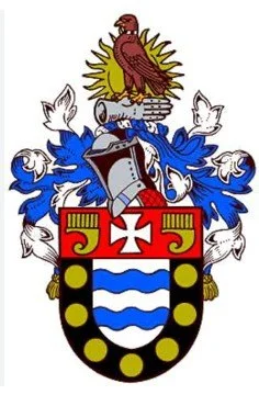
The Bude Town crest (shown below) also shows the falcon and sinister gloved hand, amongst other imagery, including heraldry images taken from the crests of the Blanchminster and Grenville families.
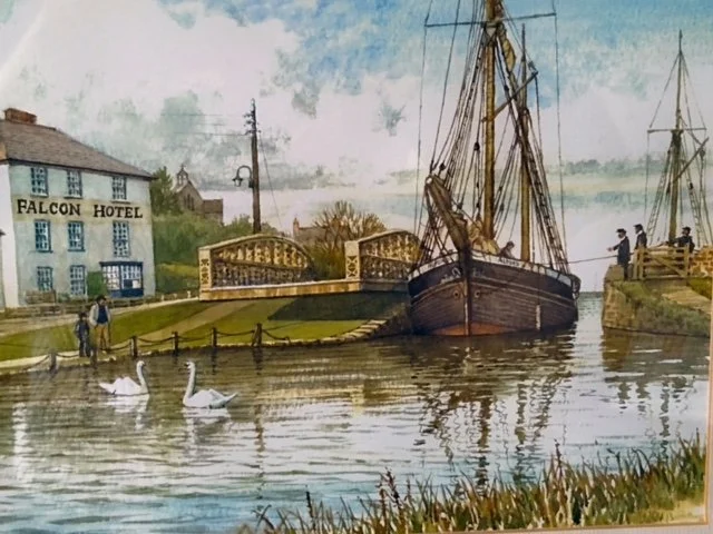
The picture shows a ship passing the swing or swivel bridge and heading into the Private Basin.
(The painting is by local artist Harry McConville and is shown here courtesy of Mr Jeremy White of Bude.)
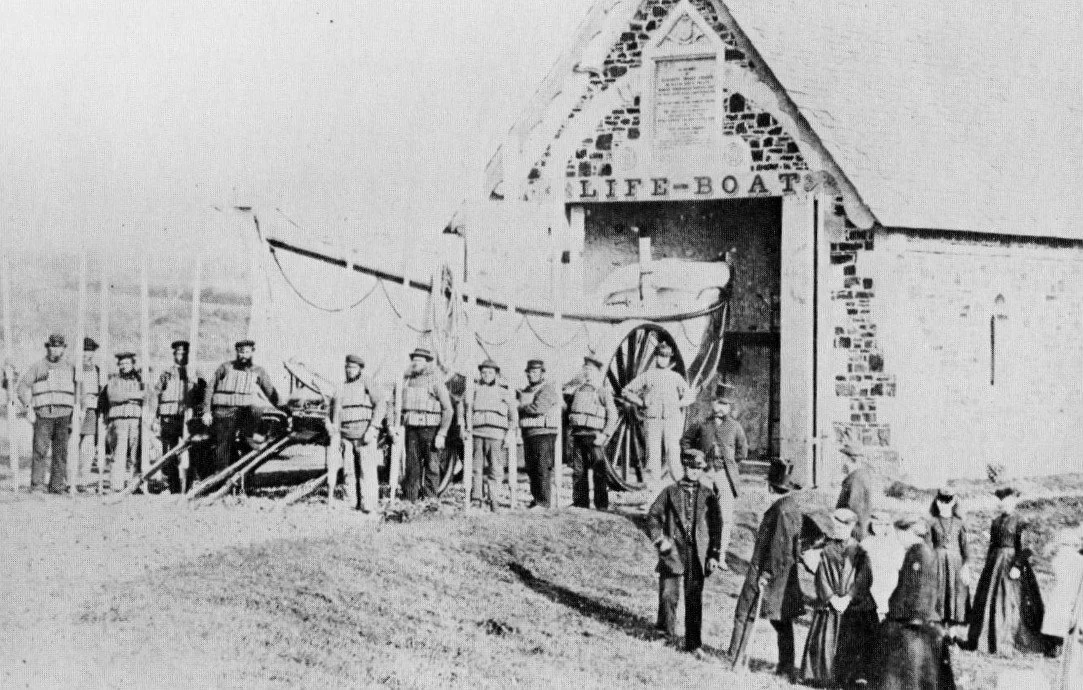
In 1863 a new lifeboat house was built alongside the Falcon bridge.
It cost £715 pounds to build on land given by Sir Thomas Acland. The building, lifeboat carriage and the new 33ft lifeboat was given by to the town by the children of Robert Garden, the Lord of the Manor of Treleigh, Redruth. The boat was named the “Elizabeth Moore Garden” in memory of their mother.
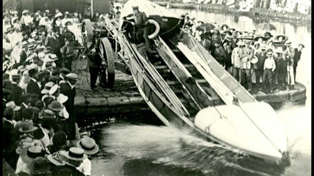
The boat could be launched into the canal or transported on its carriage to the most appropriate shore for launching straight into the sea; the latter process was complicated by the fact that the carriage had to be turned round to enable the boat to be launched stern first into the sea. By all accounts, this necessitated the leading horses pulling the carriage to head deep into the surf, often to the point of swimming!!
The first image shows the boat outside of the boat house and on its carriage; the second image shows it being launched into the Private upper Basin.
Images are from the the Thorn photo library.
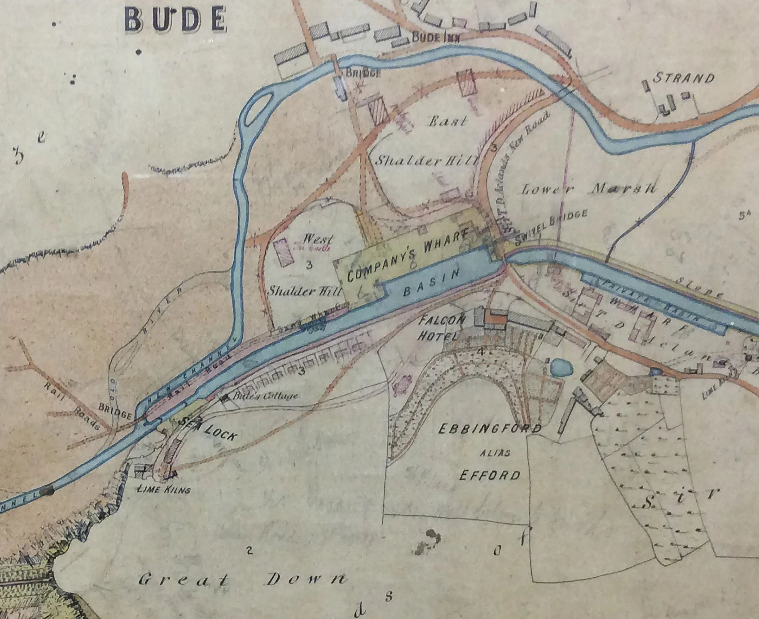
The image shows a map now in the Heritage Centre at the Castle Bude. You can just see the Falcon swivel bridge and beyond that is the the Private Basin, which was Sir Thomas Acland’s basin, where there were also warehouses.
Just to the bottom right if the map may be seen the words “Lime Kilns” - discussed shortly.
Ebbingford so clearly shown on the map was Sir Thomas’ (summer?) residence.
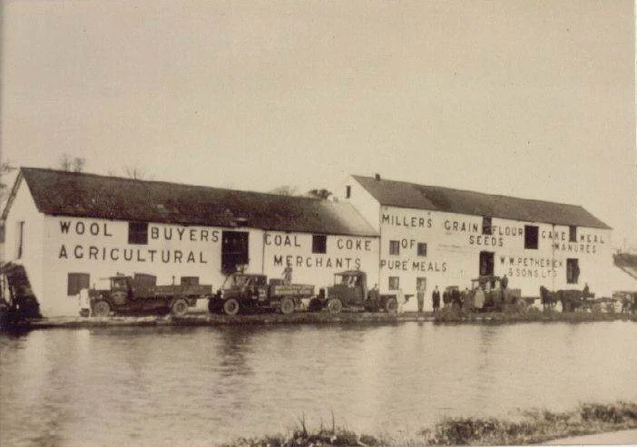
This photograph of the early twentieth century shows the warehouses alongside the Private Wharf.
There was a further warehouse to the right and just out of site of this image.
This area now has the retirement home.
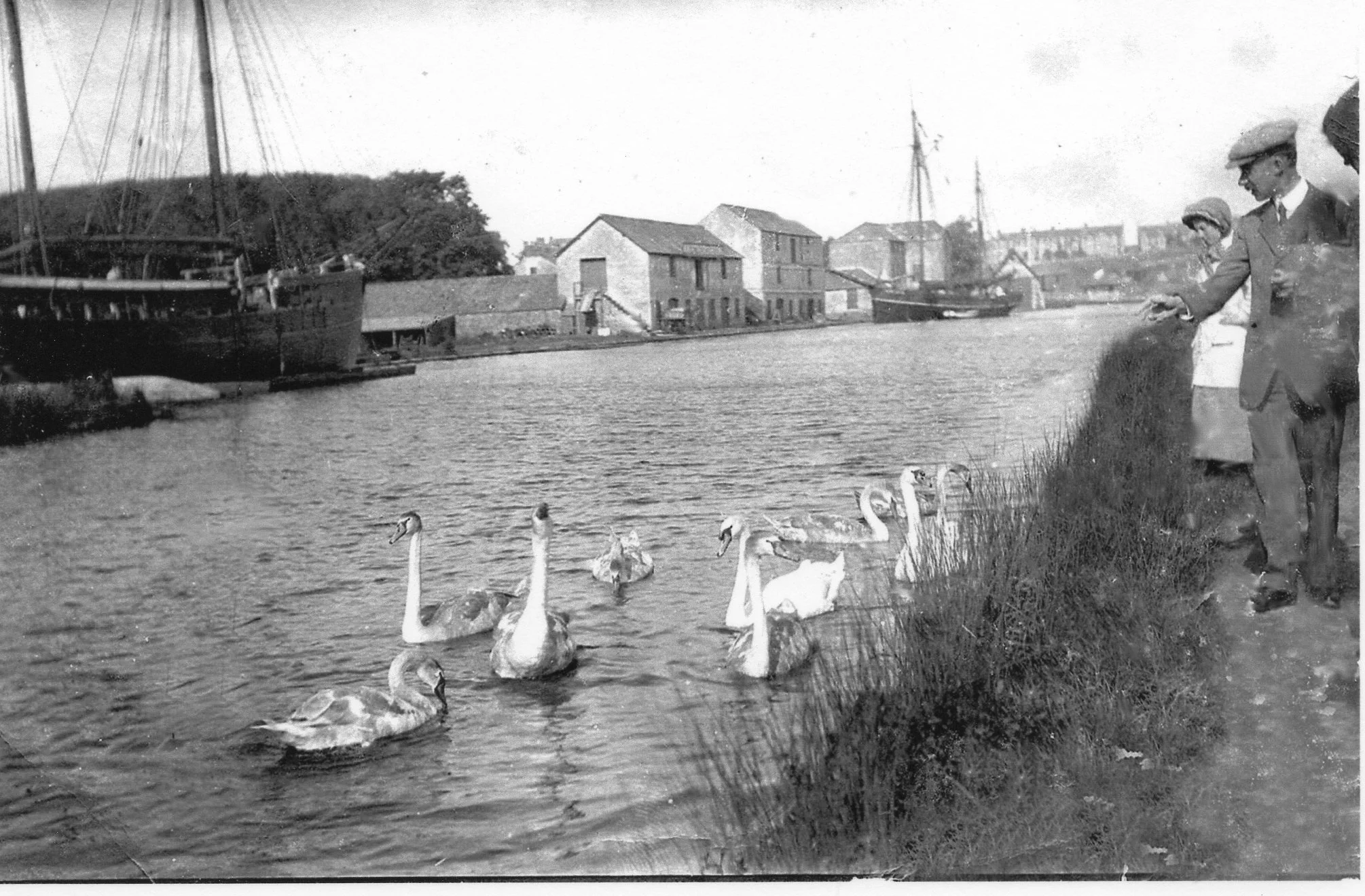
The whole area along here is a haven for all manner of wild life- not that they are very wild as most ducks, geese and pigeons will eat corn from your hand.
A Note of Interest Here.
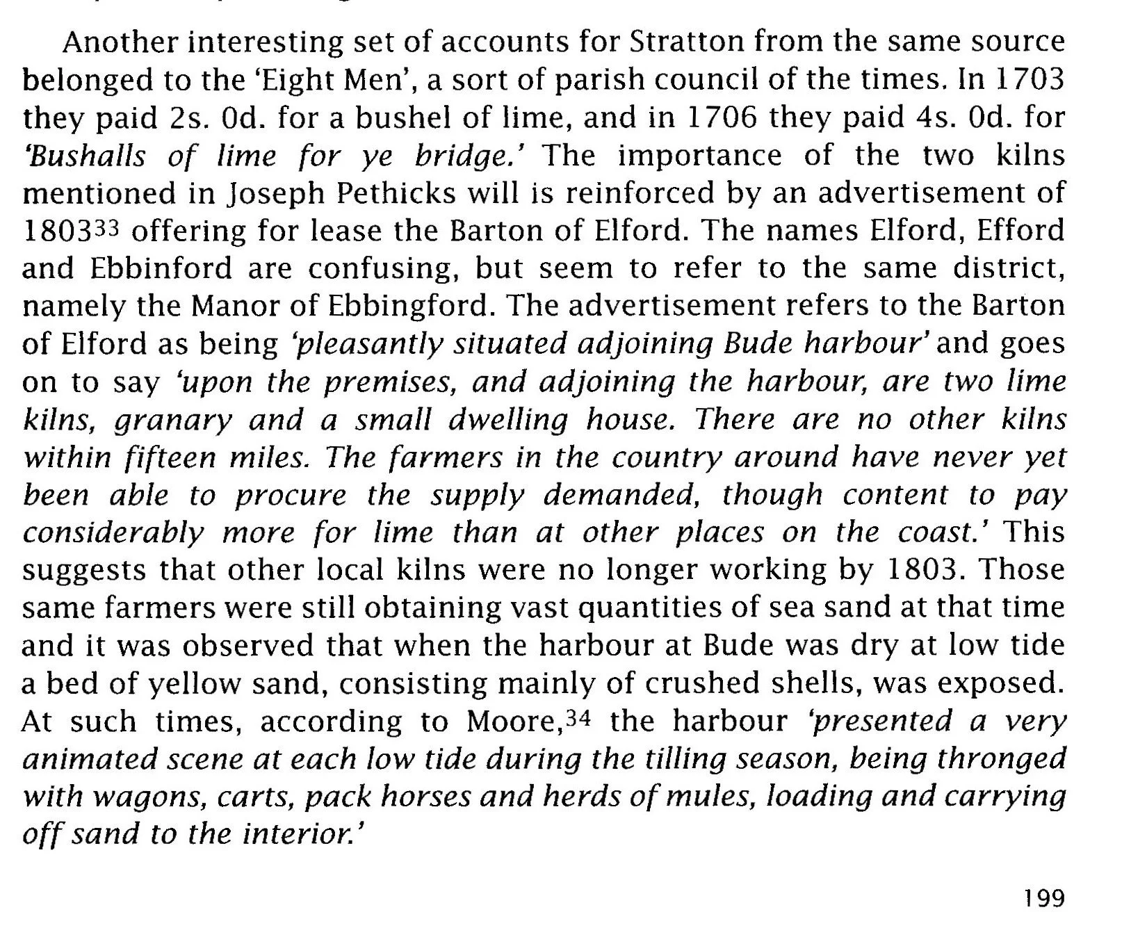
Opposite is an extract from Ken Isham’s book, “Lime Kilns and Limeburners in Cornwall”.
This extract is an advertisement for the lease of Ebbingford Manor or Barton, together with its lime kilns, which were situated perhaps 50 odd metres in front of the Manor house.
The advertisement promotes the availability of the lease on these properties dated 1803 and the value of lime and the importance of Bude sand at that time.
It is important to note that this is before the canal was built. It is of interest as it around this time that Sir Thomas Acland inherits Ebbingford Manor, or Barton. Ideas for the building of a canal was being proposed at this time and Sir Thomas buying or taking the lease for the manor will have added to the momentum for a canal to be built just 17 years later.
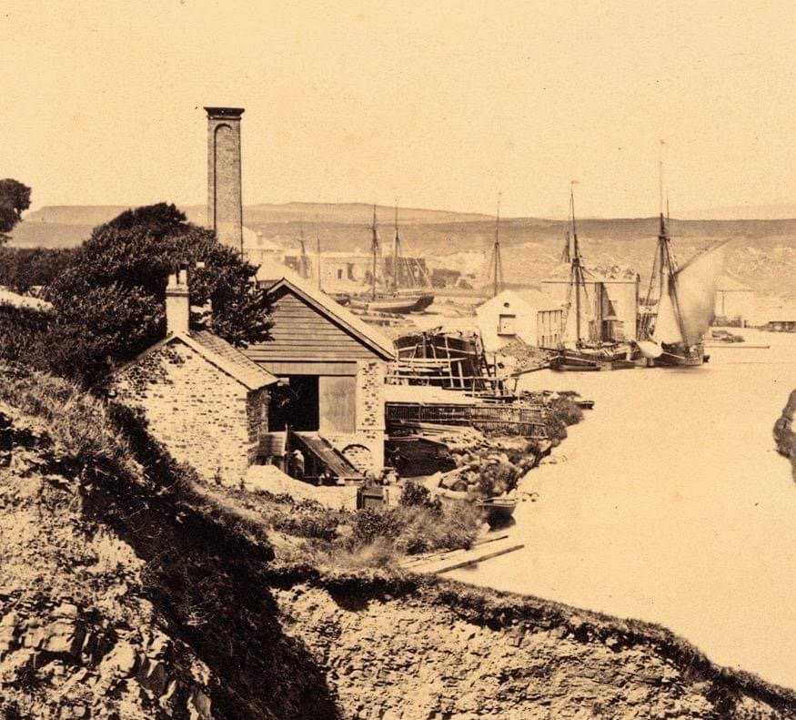
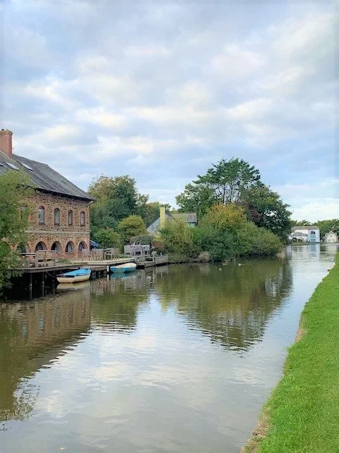
As we progress a short way along the Private Basin we arrive where the canal narrows at a pronounced corner - presently this area has the old Scout House and to its left is a canoe storage area.
This was the location of serious industry in Bude in the mid-nineteenth century.
There were three large warehouses, plus a ship building yard - and a ship can just be seen in this old Thorn Photo -but also, from around 1860/1 it was the site of the Bude Haven Steam Saw Mill Company. (See next page)
In the heyday of the canal this busy scene will have included the flow of sand barges being pulled by horses along the canal and the stabling yards for the horses themselves.
This photo that appeared on the Nostalgic Bude Facebook site some time ago shows a close up of a large ship at the Stapleton Ship Building yard.
In the background is an operational ship unloading its cargo at one of the warehouses.
The photo is believed to have been taken around 1920, long after the demise of the Bude Harbour and Canal Company.
The Master Shipwright Robert Stapleton set up shipbuilding here in the wharf in 1830. Boats were launched sideway into the canal and remarkably, ships were winched ashore by placing ropes around the hull of the ship and pulling it broadside up a greased slipway. This must have required powerful steam engines and perhaps accounts for the Steam Saw Mills.
As a footnote, prior to the construction of the canal, in 1813, William Barrow built the brig named Mary and launched it from the beach. Perhaps this is just one record of how early local boats were built.
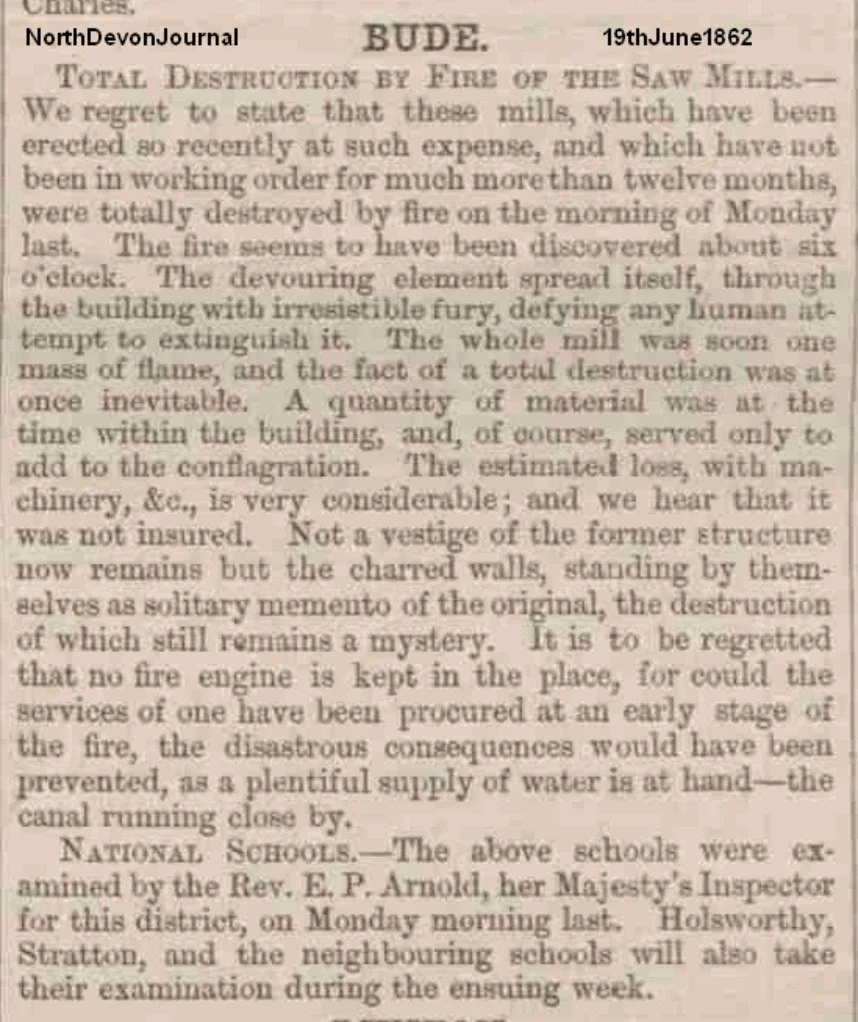
As mentioned above, in 1860/1 a Steam Saw Mills was built here but, unfortunately around a year later in June 1862 there was a major fire which destroyed the building and the health of its owner.
The fire not only destroyed the Saw Mills, it appears to have affected the health of its proprietor. The paper cutting below, dated March 1863 shows all the heavy machinery up for auction.
(The author is grateful to David Thorn who has provided all the paper cuttings appearing here.)
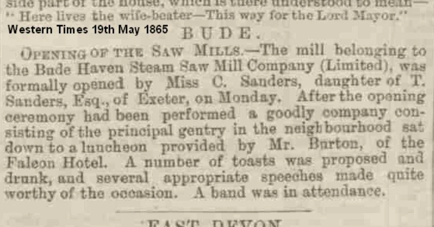
Despite the fire of 1862 and the apparent subsequent sale of the heavy equipment in 1863. We are to assume the equipment was bought by local business men as not many years later The Western Times newspaper, 19th May 1865, announced the reopening of the business.
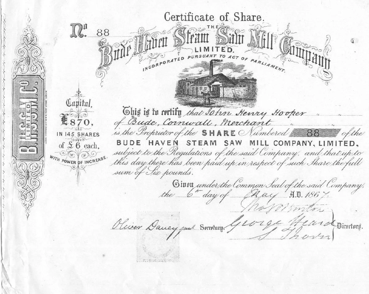
By 1867 it is clear that the restarted business was progressing well and new shareholders were being invited to join the Company.
The second image shows the shareholder certificate for Mr John Henry Hooper. The directors of the Company at that time were Mr George Heard and Mr Samuel Thorn - that is the two-times great grandfather of David Thorn who provided a copy of the share certificate.
(Samuel Thorn was a carpenter, builder, father of 9 children including three who became the local photographers!)
When the Saw Mills were eventually decommissioned the site of the Saw Mill became The Steam Laundry. Today it is a number of holiday apartments.
At one-o-clock each day the steam was used to blow a whistle to indicate the start or end of the lunch period. In the sixties, the whistle had been operated from the paint shop at Cann Medland’s Garage, Bude, until that business closed; the whistle was then operated by compressed air used to spray paint cars.
When the canal was decommissioned many of the old tub-boats and barges were deposited in the siding just along the canal from the old steam Saw Mills and later Steam Laundry.
As young children we were warned not to take the canal boats in there because, “there were sunken barges”. I am not sure any of us were old enough to know what they were but the idea that they could in some way wreck the boat was sufficient to keep most of us well away from the area!
The land falls back from the canal here and this is the site of the old quarry that probably provided much of the stone for many of the houses on this side of town.
The edge of this quarry can just be seen in the photograph shown in the earlier shipbuilding yard page.
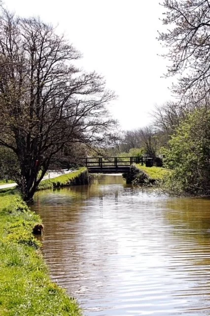
Around a kilometre along the canal bank you arrive at Rodds Bridge.
This photo shows the old bridge, a new bridge was built in 2025 and is now wider and higher above the water level and it has to be said rather modern in appearance for this location.
There was a family by the name of Rodd mentioned in the early Blanchminster documents and it has to be assumed that the bridge is named after that family.
You will be unlucky if you do not spot a kingfisher along this section during an early morning walk. You will see many wild geese and ducks, of course, but also you will probably meet a heron who will flutter off at the last moment, annoyed at his or her fishing being interrupted.
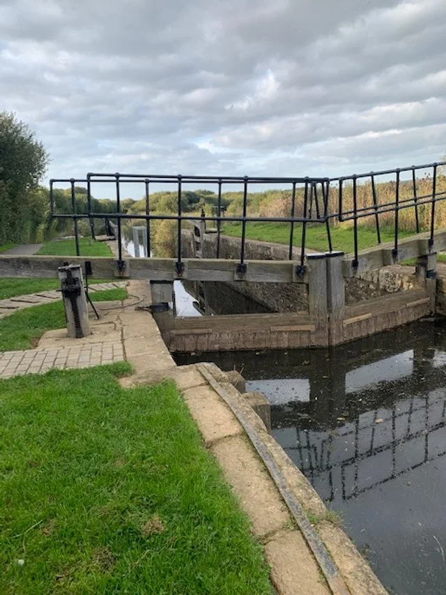
Just past Rodd’s Bridge is the first of the canal lock gates.
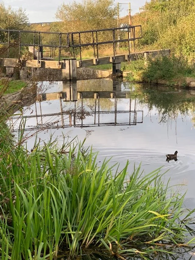
A little further on you arrive at the second set of lock gates near Whalesborough Weir restaurant.
Unfortunately, this section is slightly overgrown and remains sedimented up but it is still very much unspoilt countryside with the very old Whalesborough woods on our right and normally having much wildlife, especially in the early mornings.

Just beyond the second set of lock gates we arrive at the weir that controls the level of the river to that part of the canal. Once the canal level is achieved the excess water flows over the weir and along the river Neet estuary to Bude.
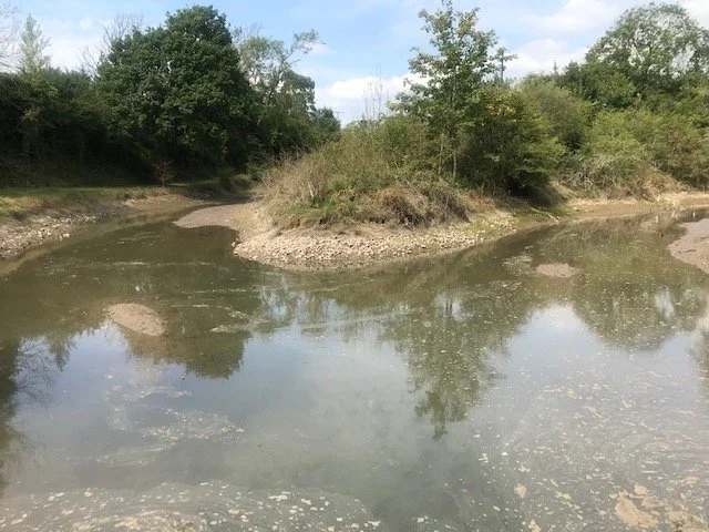
This photo shows what the confluence of the Neet and Strat rivers would have looked like before the canal building.
Around November 1820 a number of men were detailed to divert the course of the river so that it took the route towards the new canal cutting and the weir.
Further up stream of this confluence in earlier times a causeway had been built between the two rivers to enable people and trade to progress along the watershed highway further into Cornwall. This was also the only way to gain access to Ebbingford Manor on the south side of the river Neet.
Just a short distance to the south of this confluence was a track that led directly to the Salt House and Widemouth bay.

This picture shows what was probably part of the old causeway linking the rivers Strat and Neet. Today it is a footpath which leads south from the roadside opposite the bridge at Helebridge.
In more recent times this section of high ground became the route for the rail line to Bude.
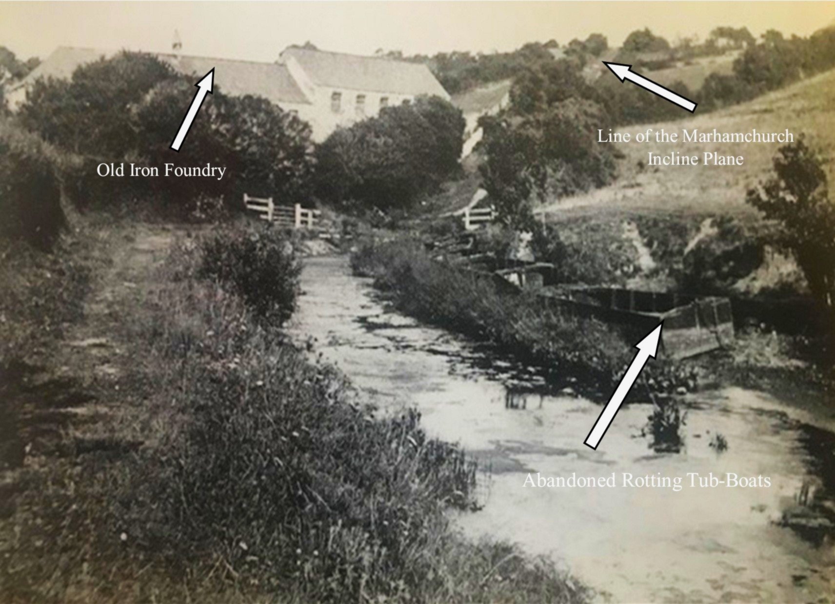
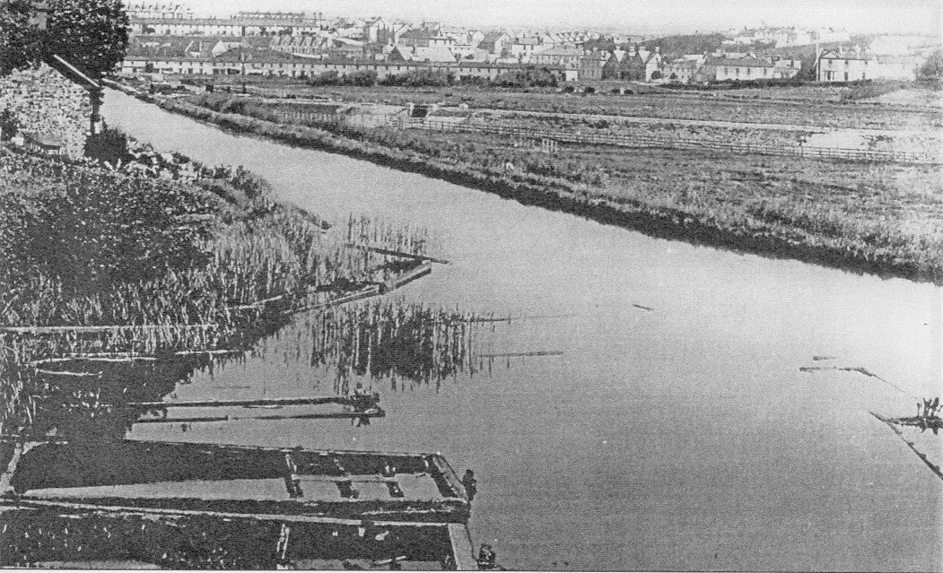
The photo shows the sad state of the Helebridge Basin around the end of the 19th century.
The tub-boats have been left abandoned and rotting; the basin filled with weed and sediments.
In the background is the old iron foundry which sat astride the river Neet and used the power of the river to drive elements of the foundry. Also shown is the line of the incline leading up to to the next level at Marhamchurch.
(Image is taken from Helen Harris & Monica Ellis’ book, The Bude Canal of 1972.
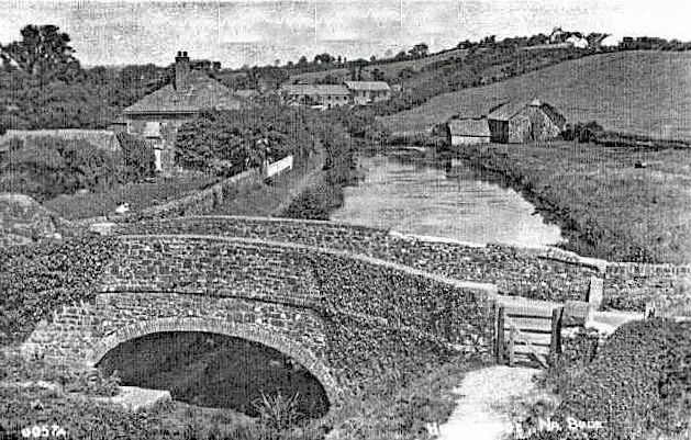

This lovely old photo shows the scene looking east towards Marhamchurch from the bridge at Helebridge. The bridge, incidentally, was built around 1820. The remains of the iron foundry can also be seen in the background at the base of the 836 ft (254m) incline plane. At the top of the incline was a 50ft (15m) water wheel which hauled the tub-boat up the incline.
In the early sixties the author was able to see remnants of the wheel house still in place.
On the right is the old canal workshops-where today is the Barge Museum, which is open to the public on Sundays during the summer.
On the left is the home on the canal side of George Casebourne, the engineer to the Bude Harbour and Canal Company from 1801 to 1876.
The second photo is of George Casebourne.
This modern photograph shows the present, largely unspoilt scene at Helebridge. The cottages on the left, which are set into the cliff on the old road leading away from the bridge, were in fact the stables for the canal horses that pulled the tub-boats.

The scene at Helebridge today.
Today it is the site of the Barge Workshop Museum which is open free to the public on Sundays during the Summer months and manned by volunteers.
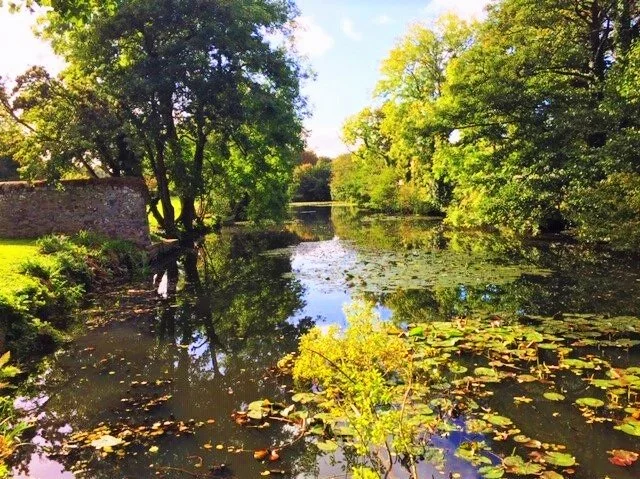
Below is the beautiful tranquil scene of the wharf were the large barges offloaded their cargo onto the smaller tub-boats. In fact some of the sand and other produce was sold direct from the wharf to the local farmers.
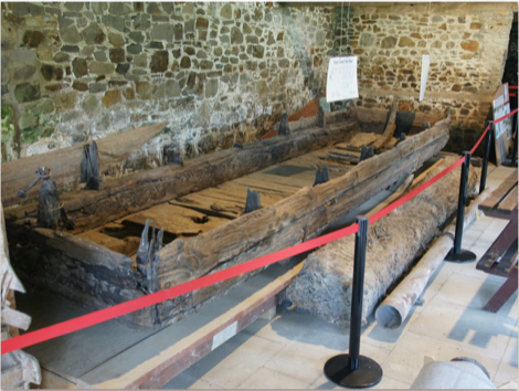
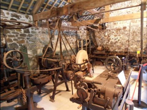
Two of the exhibits in the Barge Workshop Museum at Helebridge. This can be part of a Sunday afternoon walk along the canal, a visit to the museum and perhaps tea at the nearby Weir Restaurant. There is also a short walk along the old causeway/rail line just across the road from the bridge. There is an option to walk home by the cycle track on the northside of the estuary.
There is also free parking at the Barge Workshop and also at the Weir Restaurant.
If you wish to support the continued development of this website, please make a donation using the link below. Payment is received direct into the website operator’s own secure payment systems. You can select whatever contribution you feel able to make.