Bude to Widemouth, Whalesborough and Canal path return to Bude

This is an easy walk of 10.50k, with a few steady hills offering extensive country and coastal vistas. The first half of the walk simply follows the coastal path southwest; the route then passes through fields to Whalesborough and then the canal towpath back to Bude. All with a touch of history, the ever presence of the sea, magnificent views, farm animals and always the chance of wildlife alongside the canal. There’s usually an option of an ice cream at the carpark at Widemouth or a coffee at one of the beach restaurants and a further chance of refreshments at the Weir Coffee House and Bistro at Whalesborough- here overlooking the ducks, geese, and the fishing lake.
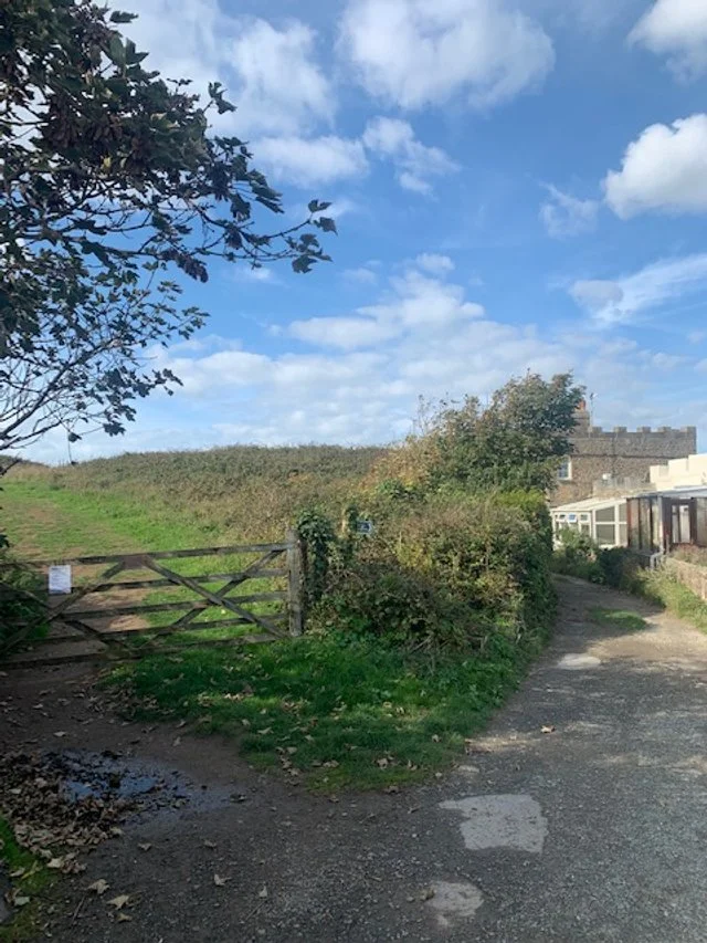
The walk starts at the Falcon Hotel. Head towards the sea taking the immediately left fork up towards the church.

On the left is the Church of St Michael’s, named after the small medieval hermitage, that existed on the Chapel Rock at the end of the breakwater. The church was built by Sir Thomas Dyke Acland in 1835 as a “chapel of ease” for the people of the hamlet or village of Bude Haven. Prior to 1835 the local people had to walk to Stratton to attend Sunday worship.
There is documentation to show that the incumbent Vicar at Stratton was not happen about losing his parishioners and he did officially complain to Church authorities, but to no avail. The original church was simple and quite small, it was renovated and enlarge in 1935.
Continue to walk along this, the Church Path, until you reach the gate leading to the cliffs.
Church Path, prior to WW11 was simply a path. However, when the 2nd and 29th Battalion US Rangers came to Bude in 1943 to prepare for their assault on the cliffs of Pointe du Hoc, Normandy, as part of the June 1944 D-Day Landings, they enlarged the path to its present state to provide access to the cliff tops for their field guns. The gate here provided direct access to the cliffs. They trained their guns at targets out to sea, while other Rangers refined their climbing assault skills on the cliffs to the north of the town. Continue along the path to its end point.
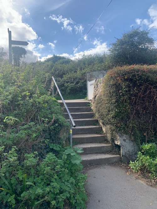
Climb the steps to the cliff path and note the small iron marker set in the earth to the left of the steps.
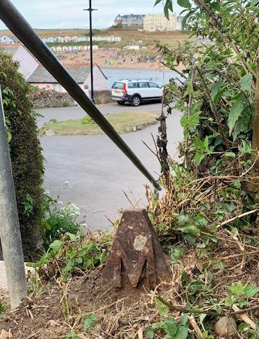
Sir Thomas Dyke Acland owned all this land as part of his Estate at Ebbingford and when his daughter Agnes married Arthur Mills, who was a member of Parliament for Taunton and Exeter, in 1848, Sir Thomas gave some land here and built Efford Down House as a wedding gift. You will see the house as you walk along the path towards the sea. The iron marker has embossed the letters “A” for Agnes on one side and “M” for Mills on the other.

Continue along the path until you arrive at this well-worn path forking off to the left and rising up to Compass Point. Efford House will be seen on your left.

For local people and for all who visit Bude, this is a favourite spot to take in the unspoilt beauty of the area. Here the tide is ebbing and exposing a beach walk for miles northward taking in Crooklets, Northcott, Sandymouth and Duckpool beaches. The lowest tide occurs around mid-day during twice-monthly Neap Tides.
Carry on your walk south-westward and up to Compass Point.

Here at Compass Point, we have something of a folly built by Sir Thomas in 1835. Its design is based on “the Temple of the Winds” at Athens. Since 1985 a Grade 11 listed building. It served as a refuge for coastguards and the “Flagman” who raised a flag on the nearby pole to indicate when it was safe for vessels to enter the harbour.
Known as “The Storm Tower” and by local people as “The Pepper Pot”, it has compass points embossed on each of its sides. Unfortunately, coastal erosion is a constant problem, and the building has been moved once away from the cliff edge and is presently being stone by stone dismantled and reassembled, that is Summer 2023.
In fact, this work was completed Spring 2024 and it is now sited in its new position safely away from the cliff edge, but somewhat incongruously, as it does not command the views that would enable it to function as a lookout.

Sir Thomas Acland was advised by his Lawyer in 1808, to ensure he preserved the downs for the people to enjoy the beauty and health-giving fresh air. He was a great benefactor to the town and in time he passed the land into the control of the local Council on a 500-year lease.
As you look northward you will see that no building encroaches on the coastline and as you continue your walk to our next stop again, there is little or no houses despoiling the natural scene.

This, of course, is an Ordnance Survey Triangulation Point and from the huge panoramic vista around, we can see why it was chosen. On a clear day the huge Bude Bay becomes apparent.
Lundy Island, at the mouth of the Bristol Channel, will be just visible in the haze to the north (Lundy plain, sign of rain!) and south-westward are the headlands of Tintagel - with the notch - and well beyond Trevose Head.
For the sailing ships of old it is said, to be caught between “Trevose Head and Lundy light, is a fisherman’s grave by day or night”.
Head down the hill, looking at the severe erosion of the cliff path- keep well clear of the edges. Continue on for some distance until the old coastguard houses appear ahead of you, when you should try to spot our next oddity.
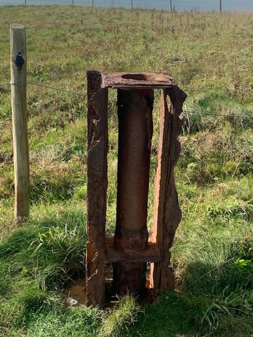
This rather sad relic is all that remains of a support for a mock ships mast. Coastguards used to practice their skills with the rescue rocket apparatus to shoot a line over the mast in all winds - stricken vessels along our shores was a common occurrence and many lives were saved in this way.
A little further on, erosion has cut-off the normal route, so you have to make a brief detour to the left and 100m walk along the roadside - which provides the chance to pass by the coastguard houses.

These are the coastguard houses with their equipment store in front of you. They are the first port-of-call for cliff rescues and maritime search and rescue together with mobilising all resources necessary to achieve a successful outcome for anything or anyone in distress or danger. They agency also have a huge range of other duties, including ensuring that ships meet and operate in a way that conform to British and International rules and much else.
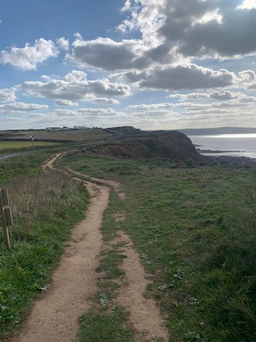
It’s a question of just following the path while taking in the views.
This provides a chance to point out that during the pen-ultimate Ice Age known as the Anglian Invasion (450,000 years ago), ice covered the whole of the sea within your present site, creating fluctuations in sea levels and raised beaches all along our shoreline to the Scilly Isles.
Choose a safe place here to observe the ribs of eroded rock platforms on the shore below. Also, observe the notches cut into the rock faces at around the 10m level. These are the raised beaches of old.

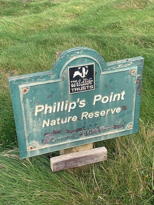
The view shown is looking north after Phillips Point.
Around 10,000 years ago, the cliff line would be about 100m seaward, and this is reflected in the vestiges of cliff forms in the rock platform. A “V” form pointing away from you reflects and anticline at the cliff-face and a “V” form, with the open face away from you, representing an anticline. The rocks all along our shore are of the Carboniferous Age and here, they form the “Bude Formation” of Massive Buff Sandstones.

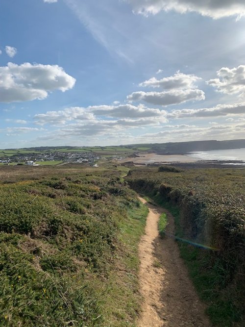
We now start to see the wild stretches of Widemouth Bay - in Cornish Porth-an-Men. Which, rather aptly means, the port for stone. Welsh Sloops landed coal and limestones here, and the vessels returned with Cornish granite, slate, tin and copper and, apparently, Cornish Pasties!

Your path now passes through a low bank, and you you now have the option to turn left, cross the road and follow the pathed route to Whalesborough; basically a short-cut to where you will re-join this walk.

If you are opting for the short-cut, this is your target gate, but you do have to cross the road.
If you still have reserves of energy, just continue the path you have been on to our next stop.
As you look down this path at the wild remote beauty, reflect on the fact that below is much more than meets the eye. Down in the hollow and buried and protected by much concrete at nuclear protection depth, is a repeater station receiving transatlantic communication. This bay and Bude bay receive nearly all modern transatlantic cables.
Perhaps the words of Rudyard Kipling in his poem of 1865 where he reflects on all that is going on in the deep, may be appropriate. The Deep-Sea-Cable:
The wrecks dissolve above us; their dust drops down from afar -- Down to the dark, to the utter dark, where the blind white sea-snakes are. There is no sound, no echo of sound, in the deserts of the deep, Or the great grey level plains of ooze where the shell-burred cables creep.
Here in the womb of the world -- here on the tie-ribs of earth Words, and the words of men, flicker and flutter and beat -- Warning, sorrow and gain, salutation and mirth -- For a Power troubles the Still that has neither voice nor feet
They have wakened the timeless Things; they have killed their Father Time; Joining hands in the gloom, a league from the last of the sun. Hush! Men talk to-day o'er the waste of the ultimate slime, And a new Word runs between: whispering, "Let us be one!"
The path takes you to the upper car park where you can usually cool down with an ice cream from the Ice Cream Van.
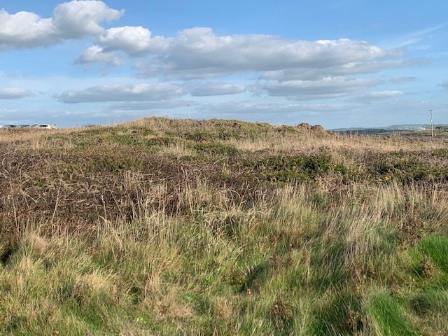
Just to the right of the carpark is a small path heading towards the sea and a short distance down the path is a burial mound. They are numerous along all prominent positions along our coastal path and were a ritual burial site for one or a number of persons, but they were also a statement of belonging. There are two in this area. Most date between 2,500 and 1,500 BC. Unfortunately, most have been robbed of their contents and few have been accurately dated. The present state of this site reflects the lack of appreciation for our heritage, we can only hope that it will be cleaned up soon and provided with some interpretation - and so near and accessible to so many. Very sad.

From the car park continue along the path towards the white cottage. This is the Salt House which has stood here since at least the 11th century. Basically, the saltings for the fish cellars. There were ten salt houses mentioned in the Doomsday Survey of 1087, but salt panning probably extends back to at least Roman times.
If there has been a recent storm and sand erosion you may be lucky enough to find the remains of what looks like a Romano-British metal smelting works, appearing on a low outcrop of rocks in the middle of the beach. The site will be evident as a reddened deposit on rocks that do not match those of the outcrop.
Roman samian ware pottery and other other pottery have been found here. Such site are believed to have serviced the needs of the neighbouring communities. There is a similar site to the north of Bude at Duckpool.
It is hard to imaging but the road that you can see and hear to your left used to pass in front of this cottage in the early 19th Century. The nature of the cliffs here offers little resistance to the power of the sea and erosion is rapid.
At the far end of Widemouth Beach there is a geological fault that marks the boundary between the Massive Bude Sandstones and the distal deposits of the Crackington Formation. Distal just mean that the sediments are those that were washed further out to sea from the continental mass which existed to our north over what is now Wales. The horizontal distance here has been halved by the compressive forces from the south.

This is a repeat of the previous picture but, of course, taken in the early 19th century.
This Thorn photo shows and proves the rate of erosion on this shore over a period of one hundred years.
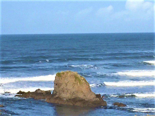
Just visible in the background is Black Rock, the prominent rock standing on the distant rock platform. Here legend has it that the Smuggler Cruel Coppinger is destined to weave cords of sand for eternity in payment for his ill deeds. Select Cruel Coppinger from the menu. See below.
In fact, the outcrop was created when the geological sediments were being laid down beneath the sea floor during the late Carboniferous period; the sediments were tilted as they formed, and the unconsolidated sediments slid down the tilted slope as a jumbled pile of rock and sludge. This becomes apparent on close inspection of the rock. It is termed as a “slumpbed”.

At the Salt House, take the pathed path to the main road and cross to the gate and style.

Pass through the style and head up left to the path alongside the hedge, until the next style.

Listen out for rabbits and birds scurrying in the thick hedge growth and enjoy the quiet of the open fields.

Go straight ahead at this point and keep to the clearly defined path, i.e., do not take the path off to the left.

Straight through the style here and along the path.

Again, the path is clearly defined, just keep fairly close to the hedge on your right to the next style.
The lands you have been, and will be, walking through, were all given, first to Brien of Brittany, following the Norman Conquest, but due to ill health he is thought to have returned to Brittany and these lands then passed to Count Robert de Mortain, half-brother of King William. He sublet the properties of Walesborough (Walesbrau), Widemouth (Whitemot) and the manor of Stratton to other Norman and Breton Lords, or sons of Lords, who fought at Hastings in 1066.
Apart from being giving a reward for their services, they also spoke Breton Cornish, which eased their acceptance into the community due to the long association of the Cornish and Breton people- being largely one of the same people. (Select Normans from the Menu for more detail.)

The path here bears a little off to the left, normally clearly defined even when the field is in full grass or corn.

Just take in the view here for a moment. Marhamchurch is now seen sitting in the middle ground, a beautiful village with much history described in the booklet, “Marhamchurch Parish History and Heritage, by Sue Proudfoot. This is available in the Village Store.
In the valley to the left is the Hamlet of Helebridge where the large canal barges from Bude off-loaded their sand cargo on to small tub-boats ready to be hauled up the incline plane to Marhamchurch. From here, in linked groups of four, the tub-boats were towed by one horse to the next incline plane at Hobbacott Down: that’s the hill in the background, slightly on the left of picture.

Your path now drops down through the field, slightly left- trending to the style at the bottom.
Now it’s time to decide whether you stop for refreshments at the Wier Coffee House and Bistro overlooking the small lake or turn right at the bottom towards the carpark.

Not only is this a good place to relax with a morning coffee, lunch, or afternoon tea, but it also has a wonderful selection of Whalesborough Cheeses.

At the carpark, head left towards this narrow entrance to the Bude Canal and your canal side walk to Bude.

Your canal-side walk bears off to the left, but you may wish to take a brief detour left across the footbridge which will take you to the hamlet of Helebridge, just 50 metres to the right. The bridge here was the ancient and only crossing to the south; the estuary of the River Neet was tidal to this point and impassable, hence the prefix Hayle.
On Sunday afternoons, the Barge Workshop is open, free to all, where volunteers will tell you all about this unique canal and its workings.

You will meet many of these sculptures along your path, some providing a comfortable seat, some with inscriptions.
An historical mystery should be mentioned here. According to recordings at the Assizes of 1283, Matilda, widow of Nicholas de la Wude, was burned at the stake at Exeter on a charge of having aided Nicholas Fraunceys to murder her husband at Dodeston, Devon. Her remains were brought here and cast into the “Agva de Neth” near Whalesbrews, (Whalesborough). The question is, why were her remains brought here and who was Matilda?
The name of Matilda does run in the local Whalesbrau and Arundell families!

The Bude Canal is unique as it employed incline planes, operated by various water powered mechanisms to overcome the many climbs and descents along its path.
The canal was needed to carry sand to the poor soil of local farmlands. The branch from Bude to Holsworthy in Devon opened in July 1823 and the final branch to Druxton, near Launceston, in 1825. Previously, packhorses carried small quantities of sand along indifferent trackways. This was inefficient and expensive.
At Helebridge the water of the River Neet was joined by two small streams to provide feeder water for the two land locks and one major sea lock on the Bude section. This weir took the overflow for the river as it continued its course to Bude. A reservoir was constructed far inland to provide water to service the various water-powered mechanisms for the incline planes.

Not much to say here other than, mind your head!

This is Whalesborough lock, the first of two away from the sea lock. These were just big enough to hold one of the large sand barges from Bude.

This is a scene that will be replicated along the path - ever changing reflections. The colours reflecting the seasons, the time of day and the weather.

This is Rodds Bridge lock. From here to Bude the canal is open to numerous kinds of boats, kayaks and stand-up paddle boards.
The canal path is also a busy route for those exercising themselves and the dogs during the early morning runs. Perhaps, with a more relaxed usage during the day.
Running parallel with the canal path, to the right, is a cycle and walking path which many use as a circular walk to Helebridge and return.
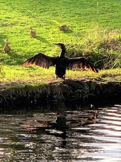
It will be a rare event if you walk this path without seeing Cormorants fishing and drying out in the warm sun. Plus, very relaxed Herons that are not sure whether to fly or let you pass right by their side.
You may also be startled by the sudden eruption in the water as a Carp breaks surface to catch a damsel fly.

This sculpture includes a little Cornish inscription, “Nans Bud”, which translates as Valley of Bude.

This is the “Peter Truscott Bridge”. Peter was a local businessman whose interest and heart was in Bude and its wildlife. He worked tirelessly to improve and preserve the local marshes for wildlife. Upon his death, the local people and Bude Stratton Council decided to commemorate his life with this bridge over the River Neet and to his beloved Marshes.

As you pass the Peter Truscott Bridge, look to your left and at the landforms. The geomorphologists amongst us believe this to be a fossilised cliff created when sea levels rose significantly during an inter-glacial period around 125,000 years ago.
There is evidence all along the fields and back gardens of the coastal fringe of sea sand and shells, at the 10 to 13m contour line.

You are now approaching the industrial section of the Bude Canal.
In the next few hundred yards were the canal quarry, the Laundry, beyond which were the shipbuilding yard and the warehouses of Sir Thomas Acland’s Private Wharf.

This, of course, is the Bird Hide overlooking the marshes. Apart from preserving the marshes, Peter Truscott just wanted to impart his love of nature to others, and he brought many groups here to observe the various birds taking advantage of the pools cleared by him.

This is the old Steam Laundry, now converted to holiday homes. In the late sixties, steam was used to sound the one-o-clock hooter. Prior to this, the hooter was located at Cann Medland’s Garage, Bude, and operated by pressurised air from their car paint shop.

Just before the Falcon Bridge we have Bude’s second lifeboat house. Built in 1863 for the new 33ft lifeboat, the “Elizabeth Moore Garden”. The boat and the lifeboat house were given to the town by Robert Garden, Lord of the Manor of Treleigh, Redruth in memory of their mother.
The boat could be launched into the canal at the east (left) end and then taken to sea via the sea lock- when the tide was in. At low tides, the boat could exit straight on to the road on the right, where it was then towed by horses to the beach, wherever that may be.

At the Falcon Bridge our walk has, of course, done full circle. This is the third bridge incarnation. The first two were swing bridges to allow large vessels to pass through to the Private Upper Wharf.
The canal story is told as a separate walk, but the background story is available from the Menu.
If you enjoy reading about our history without any adverts appearing, please help me to meet all the cost with a small donation.
For extra security, the link below will take you directly to the Paypal payment centre without an intermediate stage.
For more details of how this donation will benefit you and young local people to our area, please select “info” on the menu button.
Your payment will be much appreciated, however small, thank you.