The Rumps Promontory Castle
The Cornish Clifftop castles - or Iron Age Forts - are all spectacular and there are around 63 of them. Few can be more spectacular than “The Rumps” at Pentire Head, just to the South of Port Isaac. The walk(s) to the Rumps has outstanding views to north and south and there are two starting points. One at Pentireglaze, the other at Pentire Farm.
Which you chose will depend on your confidence to manage rough terrain and the length you are able to walk.
It should be appreciated, however, that the ground is generally suitable for those of sound-footing and there are exposed points on the way.

As will be clear from the map, there are many walk options around Pentire Head. Including a complete circuit of the promontory.
The walk described as option one on the map, involves a degree of sure-footedness. Option two is easier and could include parking at a special car park near Pentire Farmhouse. You can also walk to the the farmhouse and veer-off to the right to pick up the easier section of walk one and return along the walk two option.
The walks described start at the National Trust facility at Pentireglaze National Trust facility, as it includes car parking and a place to grab a coffee and snack.

The ”You are Here” note on this image is at the National Trust Café at Pentireglaze; 50̊ 34’ 54” N; 4̊ 61’ 21” W.
At this location you will find car parking, food, toilets and somewhere to eat inside, if required. At the Café area you will find the map shown from which you can choose your route.
And, please note that while a particular route has been chosen in the text that follows, it is possible to walk around the whole fringe of the peninsular. If all members of your party are confident on tricky, rocky paths then this is highly recommended for the unsurpassed views that will unfold.
You will see from this map that this also gives you the opportunity to discover the lead mines just beyond the second car parking area.
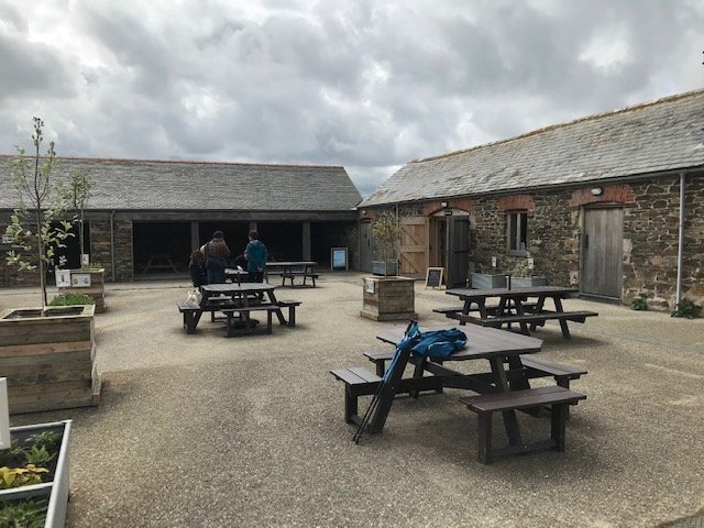
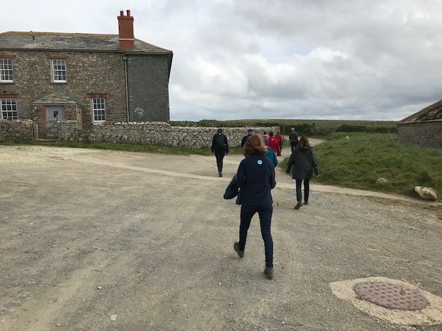
This is the National Trust café area. To commence the walk head out the main gate, turn right and walk up the hill towards the main gate. This is the route heading towards Pentire Farm, where there is also car parking.
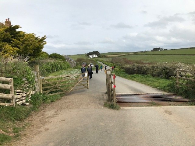
Having turned right from the café and the top of the hill, pass through the gate and cattle grid and head up the road towards Pentire Farm.
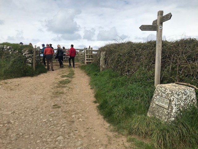
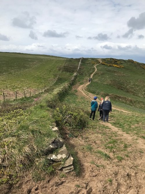
At Pentire Farm veer-off to the right and walk up the path until you reach the signpost shown and pass through the gate on the right. This will take you to the easier part of route one.
As you join the path along route one easier section, you have a view north towards Tintagel and the whole of Bude Bay and up to Lundy Island.
Here you can reflect on the fact that just twenty thousands years ago the sea would not be in sight; having receded back to the Continental slope due to the affects of the last Ice Age.
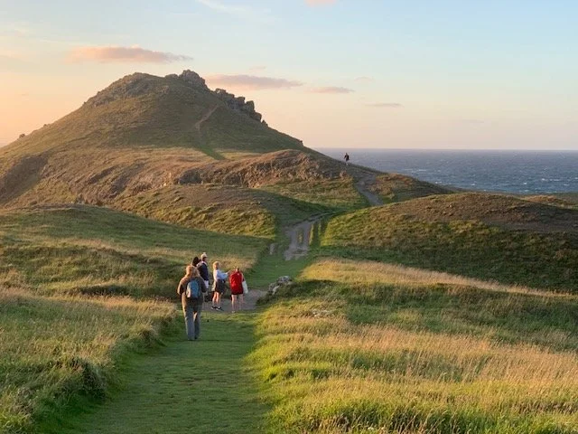
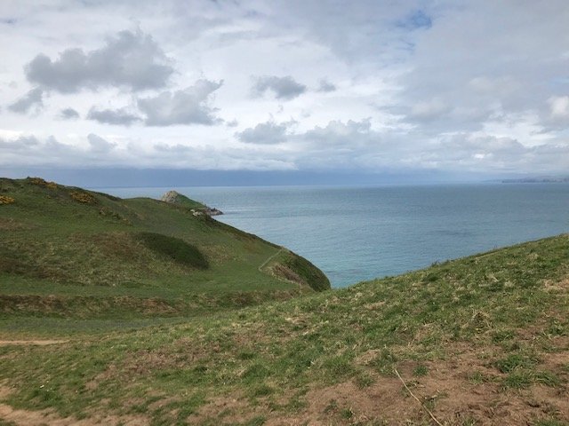
This is the view along the route one path towards the Rumps on the north side of the headland. The view down to the Rumps is just over the brow.

This is the bay just to the north of the two humps that represent the Rumps. This bay would be where the trading mariners would pull in to avoid the worst of the bad weather or trade goods. Due to the affects of the last Ice Age, the land in those early times would be much higher that today, relative to the high tide line. This would mean that there would probably have been a sandy bay here at that time.
Another less obvious consideration is the fact that as the tide flows in a strong current would aid progress northward for the small ships and local trading vessels; the opposite would be true as the tide ebbs. This is due to the filling and emptying of the Bristol Channel to the north. These currents were a major consideration for the early trading vessels as they made their way supplying goods to all the British nations along the western coast of the (now) UK; i.e. Ireland, Wales and Scotland. Trade in those early times was only practical by sea.

It is difficult to imagine a more spectacular scene than your approach to the Rumps and the defensive banking, along which there will have been a tall palisade. The banks and ditches are much eroded from their originals. We can imagine a scene here where a group of individuals were assigned the task of guarding the precious goods, on behalf of their local community, to be traded until such time as the trading vessel arrived. And, of course, making safe the goods obtained in exchange.
Trading would almost certainly have taken place only during the summer months and the people on the site would have also lit flares to guide shipping along the coast, much as a lighthouse does today. There are at least 60 plus such cliff castles along our Cornish coast. Previously, these castles were thought to be the home of local chieftains but this seems unlikely; that is not to say that the person engaged to trade on behalf of the community was of low status in the community.
The people on the cliff castle would also have charge of the sheep that would graze the local pastures and this may have continued into the winter months as the grass would continue to grow along the coastal fringes, whereas growth at higher elevations would halt during the winter. This coastal grazing is still practiced today by farmers. Of course, the animals will have been herded behind the palisades at night, away from predatory animals and possible animal rustlers.

This image is looking back at the rumps from the south. As you exit the cliff castle turn to your right and walk up the tricky path towards where this photo is taken. Careful foot placement is required and care of animals and children necessary.
As you walk this part of the path, note the scene to north and south and imagine the difficulties presented to trading vessels unfamiliar with this coastline. How could they know safe anchorages and which community wished to trade unless there was some agreed signalling procedure.
Also, as this was such an important trading route from the Mediterranean and all Atlantic seaboard nations, it was in everyone’s interest to ensure safe passage and this would have helped keep the Cornish coast a comparatively stable location within these lands.

This image is again looking back to the Rumps. As you complete the climb out from the rumps heading south, you will arrive at this sign directing you to Pentire Farm. Head down this path.
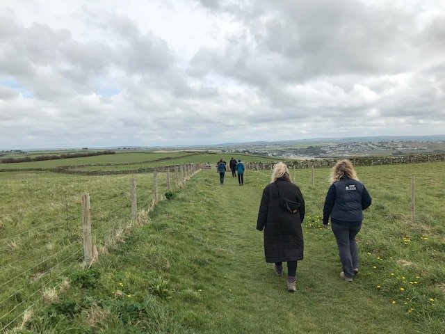
Having taken the path towards the farm you now have a beautiful walk along the fields with views down the south coast of Cornwall and into Polzeath and the Camel Estuary - not to mention much of Cornwall and the Moors.
The grass fields will give way to a wide stony path and eventually you will arrive at Pentire Farm. Here, seek out the sign indicating the road back to Pentireglaze from which you departed.
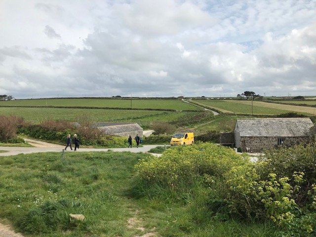
You will soon arrive back at the gate and cattle grid and the scene in this photo as you walk back down to Pentireglaze and a cup of well-earned tea and cakes - or a Cornish pasty!